Day 5 Fanny Cove to Peak Charles
Tuesday, 22nd December 2015
-
- Fanny Cove to Peak Charles
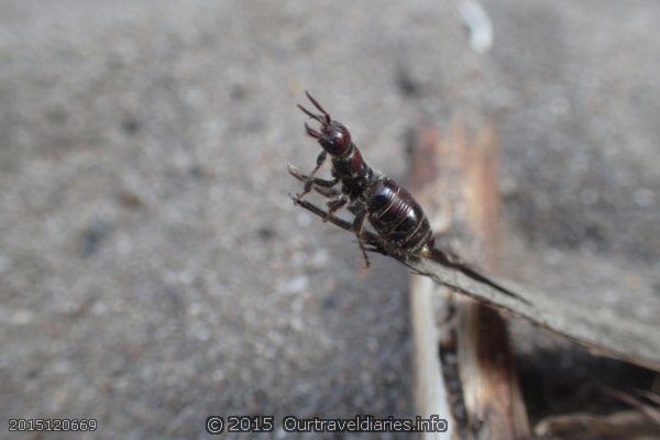
We’re leaving this lovely camping spot and going to take a look around Shoal Cape and Moir Homestead.? On the way we saw a grub and with a little help from the Dept. of Ag it was identified as a Scarab Beetle larva ( aka a curl grub ) along what is the road out. After taking some photos? and moving it out of harms way we were off.
-
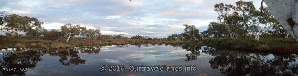
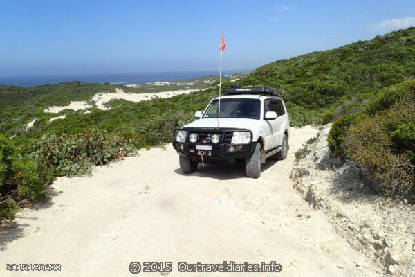
- Packed up ready to leave, apart from the footprints you wouldn’t know we’d been there – Fanny Cove
-
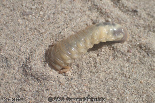
- A Scarab Beetle Larva burrowing on the road out of Fanny Cove camp ground (aka curl grub)
-
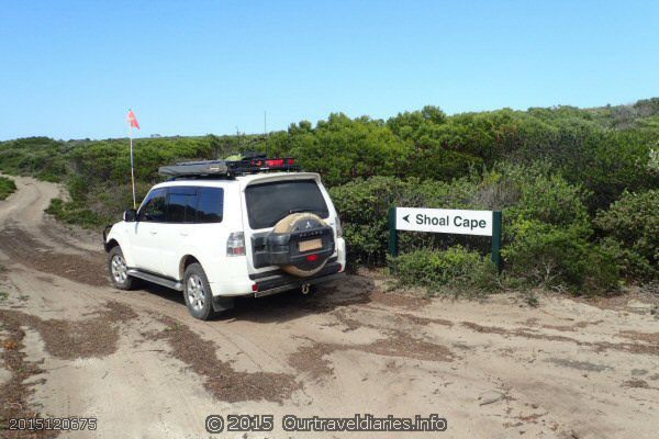
- Heading Towards Shoal Cape, Stokes National Park
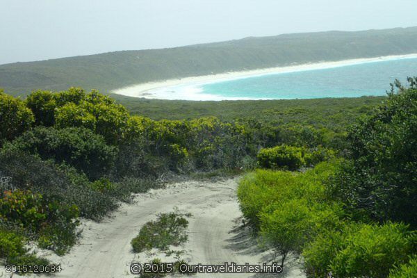
Shoal Cape is a short drive from Fanny Cove. The track to Shoal Cape is littered with picturesque views of the Southern Ocean which change around every corner. Once at Shoal Cape there are a couple of camping spots and a small car park. A short walk down the steps takes you to a viewing platform and then down to the beach. The viewing platform offers a great view of the Southern Ocean which was a bit calmer here than back at Fanny Cove. Along the way down to the beach and even at the base of the coastal dunes we saw several varieties of coastal wildflowers.
-
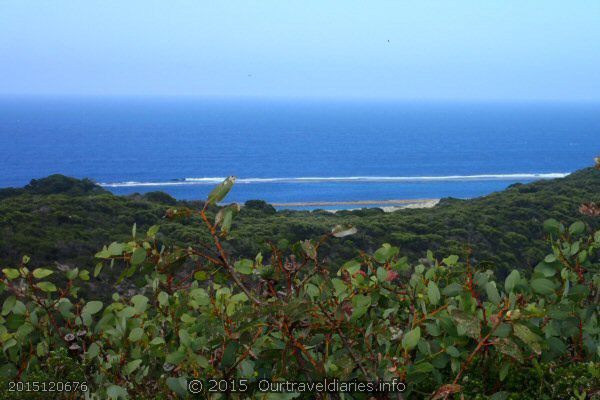
- The coastline on the way to Shoal Cape – Stokes National Park
-
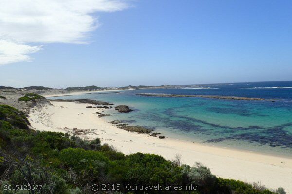
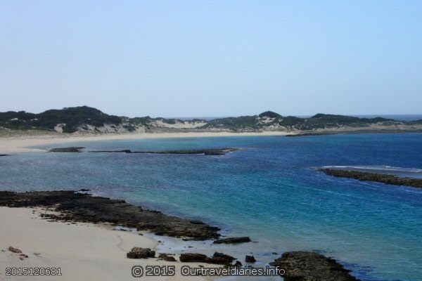
- The Beach at Shoal Cape – Stokes National Park
-
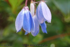
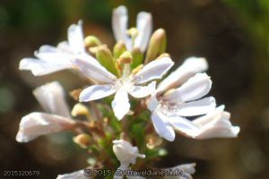
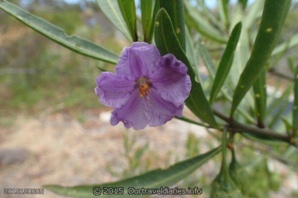
- Australian Bluebell at Shoal Cape – Stokes National Park
-
- Local wildflower growing on the dunes at Shoal Cape
-
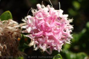
- Pink Rice flower growing on the dunes at Shoal Cape – Stokes National Park
-
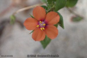
- Coastal wildflower – Stokes National Park
-
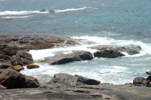
- The Southern Ocean at Shoal Cape – Stokes National Park
-
- Coming back from Shoal Cape, Stokes National Park.
-
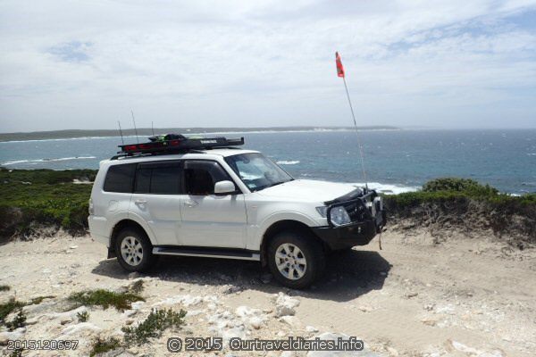
- One of the tracks we travelled in Stokes National Park
-
- Coastal wildflower – Stokes National Park
We now had to backtrack to Fanny Cove then turn left to head on out to Moir Homestead.
-
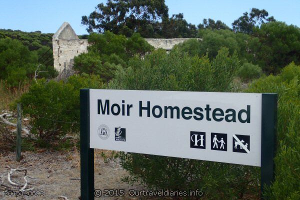
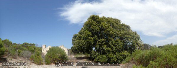
- Entrance to Moir Homestead – Stokes National Park
The short walk from the car park down to the ruins was lined with banksia trees, we’ve never seen so many in one spot.
-
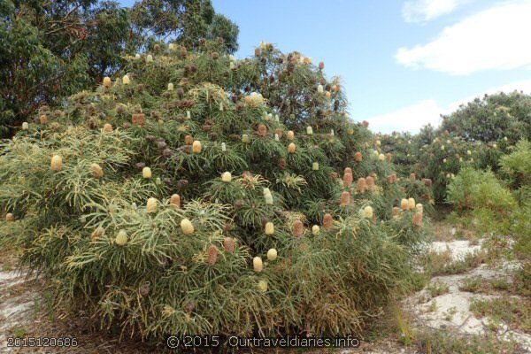
- Banksia tree at Moir Homestead – Stokes National Park
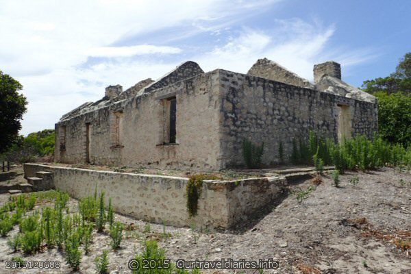
Alex & John Moir took the lease of 14000 acres at Fanny Cove in 1873 but their first choice to build wasn’t suitable due to a lack of water. They relocated to the current location which is 2km from Fanny Cove and built the homestead comprising of a 2 room cottage, a blacksmith shop, shepherd huts and some other buildings. They used local limestone and timber. Alex & John were instrumental in opening up the region; cutting a track to Dundas, selling stores to miners landing from ships in Fanny Cove and those who were heading overland to Broomehill and they carted flour to Coolgardie. The Moir’s continued to own and farm the land until 1949 when sadly Litchard Moir was found dead approx 6kms east of the homestead. It’s thought he had a heart attack.
Indigenous Australians lived in the region for thousands of years prior to white settlement and created a society and lifestyle in these harsh surroundings and I’m sure they suffered hardships too although they worked with the land and nature using it to their advantage.
The early settlers used a different approach to creating a lifestyle that in some way replicated what they had left behind. Because their needs and desires included a sense of permanancy it was probably harder work for them. It’s hard to imagine toiling as they did in harsh conditions without the mod cons we enjoy today. The Moirs and other early settlers and explorers, John Forest, John Septimus Roe, John Holland, The Dempsters and others all played a part in settling and it must be said altering the region. That said I don’t think too many people would would be inclined to replicate their efforts. Gee, we drove here in an air conditioned vehicle!
-
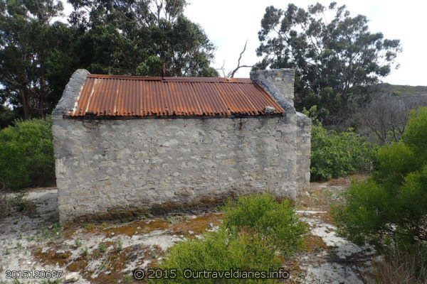
- One of the 5 remaining buildings of the Moir Homestead – Stokes National Park
-
- Remains of the shops at Moir Homestead – Stokes National Park
-
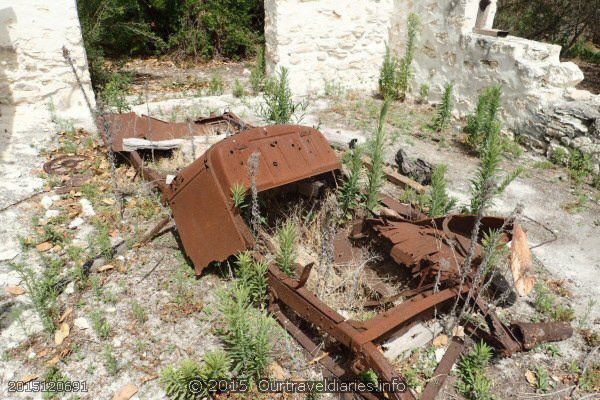
- Remains of one of the farm vehicles – Moir Homestead
The site of the homestead is dominated by a large Morton Bay Fig tree which was full of fruit still ripening. The tree is a magnet to birds and the ranger told us many visitors help themselves to a feed of figs.
Just beyond the fig tree we were privileged and excited to see a kangaroo laying in the shade with a joey in her pouch. She allowed us to get some photos of her. There was another roo resting a bit further away.
-
- The Morton Bay Fig tree is at least 100yrs old – Moir Homestead
-
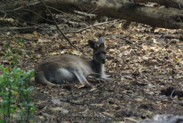
- Mum roo and her joey in the pouch – Moir Homestead
-
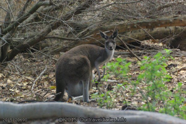
- She posed for a photo – Smile – Moir Homestead
We headed back toward Quagi Beach were we planned to have some lunch before heading on to Peak Charles where we’d make our camp for the day. As much as we love the red dirt we never tire of seeing our beautiful coastline and took some more photos along the Quagi Beach coast. Quagi Beach offers camping and allows dogs. The Shire of Esperance manages this camp site and there is a $10 per person camping fee.
-
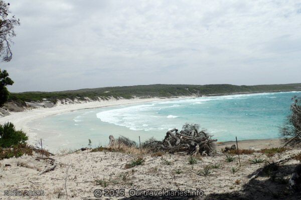
- Quagi Beach, West of Esperance, Western Australia
-
- A few Kms West of Quagi Beach
-
- Along the Coast, West of Quagi Beach
Along the way to Peak Charles we saw some tall skinny wildflowers which reminded hubby of Triffids so that’s what we called them until we got home and identified them as Red Rods. They flower in summer and thrive in the dry arid surroundings. Growing to a height of 2mts they really stand out against the low surrounding shrub land.
-
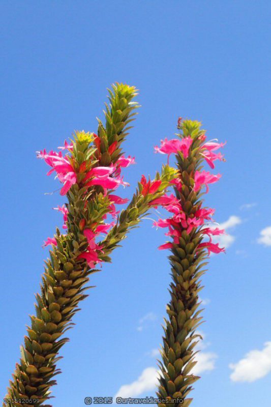
- “Triffids” – Red Rod Wildflower – near Peak Elenore
You always know when you’re approaching Peak Charles. Rising 500mts from the flat land it can be seen for about 50kms from every direction and as you get closer you can see Peak Eleanora, a little smaller than Peak Charles. John Septimus Roe ( Roe Hwy ) named Peak Charles after Governor Charles Fitzgerald while Peak Eleanora was named after Charles’ second wife. It is a lovely spot to camp for a night or three and is Free!.
-
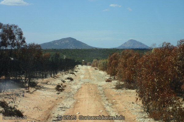
- South of Peak Charles (Right) and Peak Eleanora (Left)
When we arrived we picked our camping bay and as hubby was reversing in I spotted a Gould’s Goanna in his hole just next to our bay. Hubby stopped reversing so I could get a photo but as I opened the back door to get the camera it fell out – Doh!! I grabbed it anxious to get a photo before the goanna fled but it wasn’t working. A quick repair by hubby allowed me to get some great shots. We set up camp and the goanna was our neighbour for the evening. The camera only works in manual mode now 🙁
-
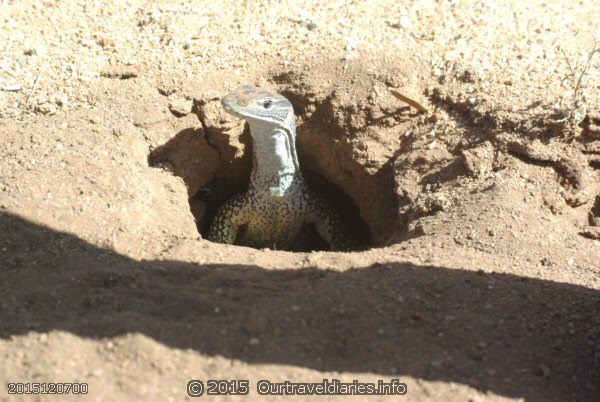
- Goulds Goanna , this little guy was our neighbour at Peak Charles camp ground
-
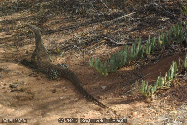
- Goulds Goanna, also known as Race Horse Goanna, near our camp site – Peak Charles camp ground
Views: 1936